
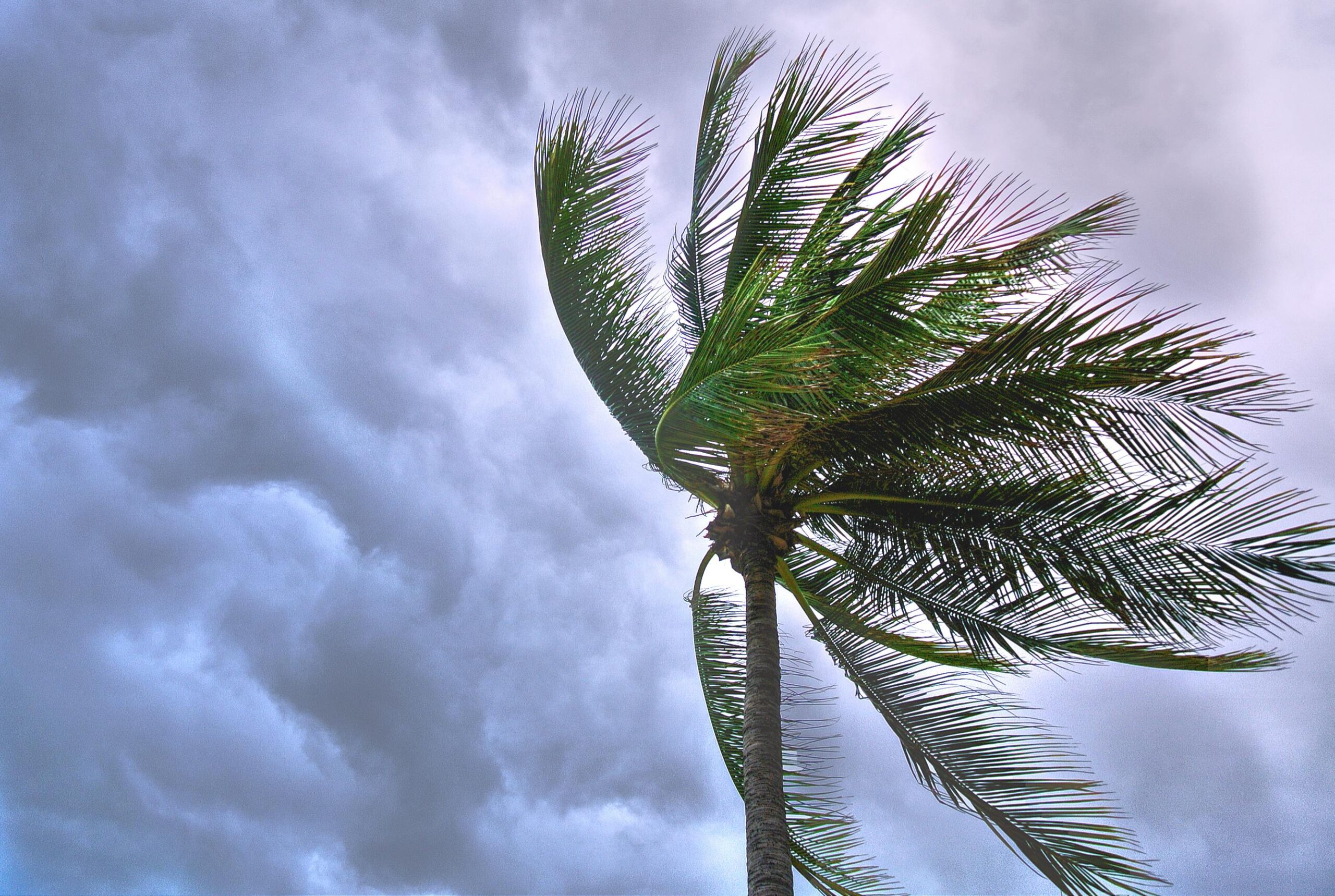
Tropical Storm Debby has transitioned from a hurricane, making landfall in North Florida around 7 a.m. Currently positioned approximately 25 miles west of Lake City, Debby is advancing inland with significant impacts expected to unfold across the southeastern United States throughout the week. Debby has been downgraded from a hurricane to a tropical storm. Tragically, at least four people have lost their lives as the storm barreled across the Florida Straits. Additionally, 275,000 customers are without power across Florida. The storm is now taking aim at Georgia and South Carolina, and the National Hurricane Center warns that this remains a life-threatening.
Dangerous conditions persist in Florida’s Big Bend region, where a storm surge warning remains active. The central area of Debby continues to experience tropical storm-force winds, widespread heavy rainfall, and a significant storm surge. These hazardous conditions are expected to spread northward along the southeastern coast, impacting areas from Northeast Florida through Georgia and South Carolina.
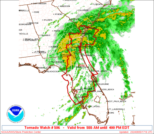
The radar imagery shows Debby positioned between Tallahassee and Lake City, with an extensive rain shield covering southeastern regions, extending into Savannah and moving towards Charleston. The trailing rain bands continue to affect the Florida peninsula, with a heightened tornado threat spanning from Florida to South Carolina.
A tropical storm warning is in effect from Longboat Key to Indian Pass, including the Tampa Bay region and the east coast from St. Augustine to South Santee River, South Carolina. The regions will experience tropical storm conditions throughout the day and into the night as Debby progresses northward.
Debby’s forward speed, currently at 10 miles per hour, is expected to decelerate significantly between Tuesday and Friday. This slowdown will result in prolonged extreme rainfall events across coastal areas of Georgia, South Carolina, and potentially North Carolina. Rainfall totals are predicted to reach between 10 to 20 inches, with isolated areas experiencing 30 inches or more.
Widespread power outages have been reported, particularly between Tallahassee and Gainesville. Residents using generators are urged to follow safety protocols to prevent carbon monoxide poisoning. Generators should be operated outdoors and away from homes to ensure proper ventilation.
A storm surge warning is active for the west coast of Florida, from Longboat Key through the Big Bend region up to the Suwannee River. Expected inundation ranges from two to six feet, with elevated water levels likely to persist through multiple tidal cycles. Similar warnings are in place for the Georgia coastline up to central South Carolina, with expected inundation of two to four feet.
The southeastern coast faces an unprecedented rainfall event, with 20 to 30 inches anticipated in some areas. The excessive rainfall poses a catastrophic flooding risk, with potential for water rescues and widespread evacuations. Roads may become impassable and erode, creating hidden dangers. Residents are advised to stay informed and heed evacuation orders where necessary.
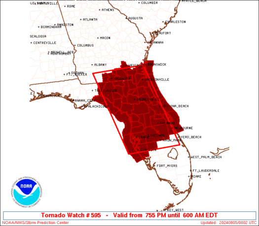
A Tornado Watch is in effect for regions including Tampa, Orlando, and Jacksonville, extending up the Georgia coast. Tornadoes may develop within the outer rain bands today, adding to the hazardous conditions.
The primary threat from Debby will be the extreme rainfall and consequent flooding across the southeastern US, extending from central Florida to northeastern North Carolina. Storm surge inundation will continue to pose a significant risk along the Gulf Coast and southeast coastline. Residents are urged to stay indoors, follow local advisories, and remain vigilant as Debby continues its slow advance inland.