

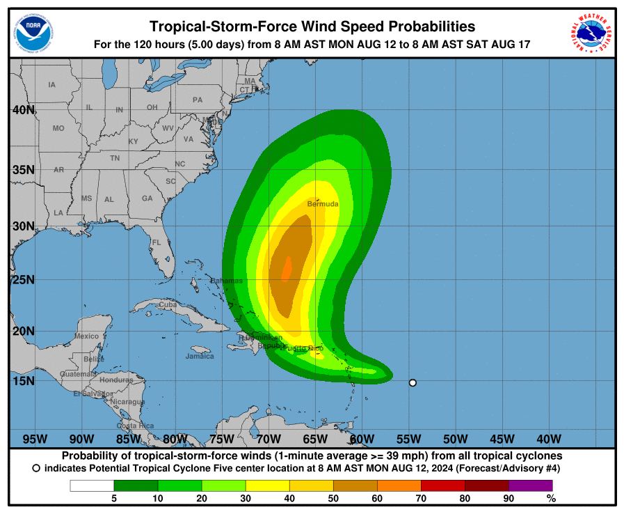
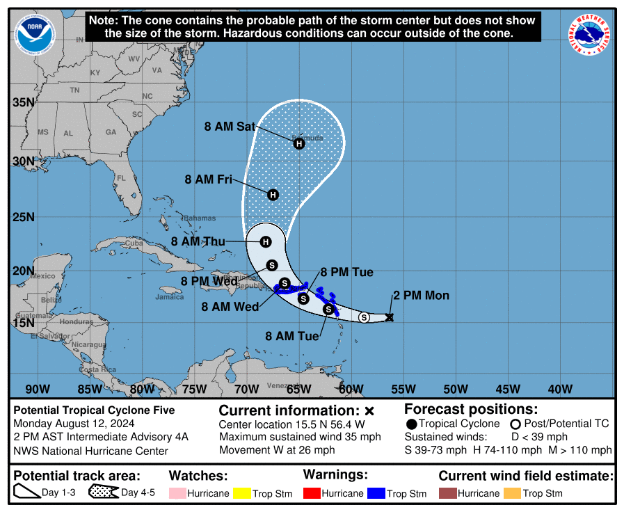
Potential Tropical Cyclone Five is rapidly advancing towards the Leeward Islands. By mid-week, it could evolve into a powerful hurricane, impacting the Virgin Islands, Puerto Rico, and potentially the western Atlantic.
Meteorologists anticipate that it will reach depression status within the next 12 hours and possibly become a tropical storm within 24 hours. At present, the system is approximately 435 miles east-southeast of Antigua and around 730 miles east-southeast of San Juan, Puerto Rico. The storm is moving quickly westward at a speed of 26 miles per hour, with maximum sustained winds recorded at 35 miles per hour.
Radar data from the Barbados Meteorological Service has begun to show increased shower and thunderstorm activity to the east of the Leeward Islands. The weather patterns are expected to bring significant rainfall to the islands starting later today, continuing through the night, and spreading northwestward. Rainfall is one of the primary hazards associated with tropical storms and hurricanes, particularly in the Caribbean, where it can lead to flash flooding and mudslides.
Tropical storm warnings are in effect for several regions, including Guadalupe, the northern Leeward Islands, St. Kitts and Nevis, Montserrat, Antigua, Barbuda, Anguilla, St. Martin, St. Barthelemy, the British Virgin Islands, the U.S. Virgin Islands, and Puerto Rico, including Culebra and Vieques. Residents in these areas should prepare for tropical storm conditions within the next 36 hours.
The northern Leeward Islands could experience tropical storm-force winds as early as tomorrow morning, with these conditions spreading westward into the Virgin Islands by Tuesday evening and reaching Puerto Rico overnight from Tuesday into Wednesday. In Bermuda, potential impacts could begin as early as Friday.
Rainfall is often the deadliest hazard in Caribbean storms, and this system is no exception. Widespread rainfall totals of 4 to 6 inches are expected across the Leeward Islands and the Virgin Islands, with localized amounts in Puerto Rico possibly reaching up to 10 inches. This heavy rainfall poses a considerable risk of flash flooding and mudslides, particularly in areas with steep terrain. Residents are advised to monitor updates from local meteorological services and heed any flood watches or warnings issued.
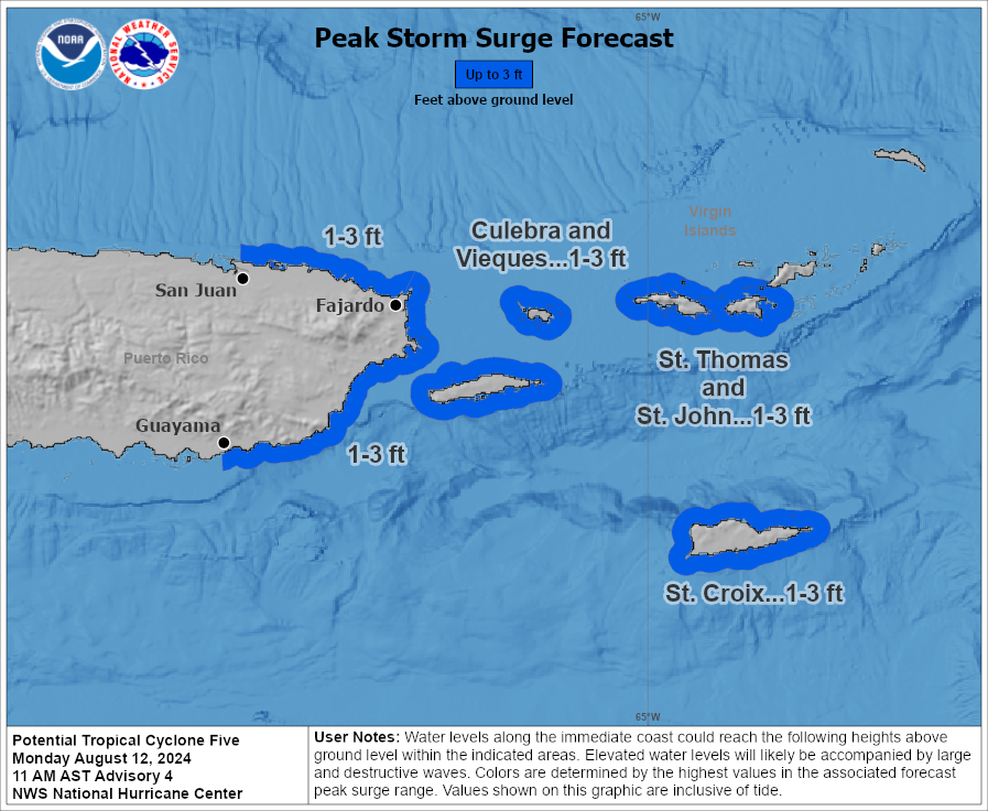
While a significant storm surge is not expected, there is still a possibility of coastal inundation. The U.S. Virgin Islands, Culebra, Vieques, and the eastern third of Puerto Rico could see storm surge levels of up to three feet above ground level. The areas most at risk include the coastlines from Guayama on the south coast to San Juan on the north coast of Puerto Rico.
Potential Tropical Cyclone Five is on track to develop into a tropical storm as it impacts the Leeward Islands tonight, with further strengthening expected as it moves northwestward. The most significant hazards associated with this system are likely to be heavy rainfall, flash flooding, and mudslides, particularly in Puerto Rico and the Virgin Islands. While the storm poses no direct threat to the U.S. East Coast at this time, it could generate dangerous surf and rip currents later in the week.