

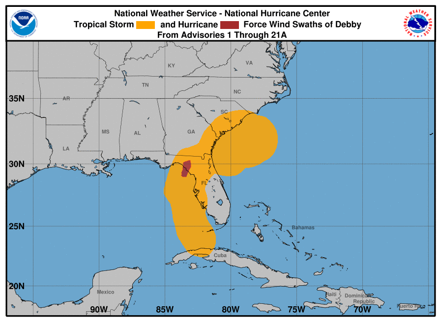
Tropical Storm Debby is moving northeast at approximately 6 to 7 mph, with maximum sustained winds now near 60 mph. As it edges closer to land, the risk of flooding and severe weather conditions extends across the Carolinas and potentially impacts the Mid-Atlantic and Northeastern United States.
Debby is currently centered offshore, beginning a more consistent movement toward the Northeast. It is projected to make landfall along the South Carolina coast late tonight or early Thursday morning. Once it reaches land, Debby is expected to accelerate northward through South Carolina into Central North Carolina by Thursday. The storm’s path will then take it across Virginia and into the Northeastern United States, eventually reaching Eastern Canada by Saturday.
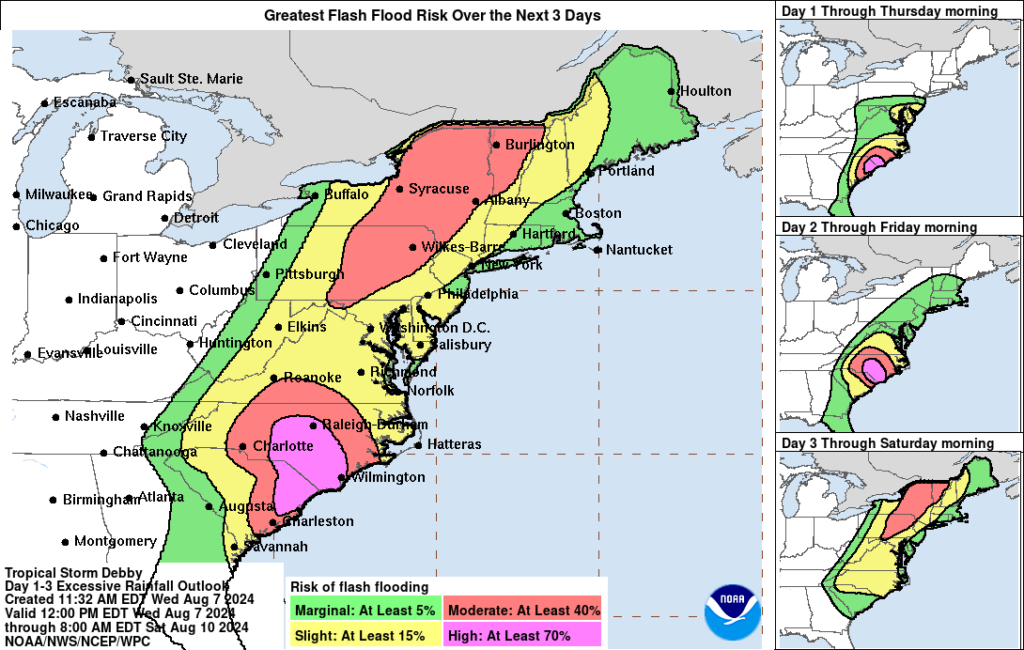
Coastal South Carolina and Southeastern North Carolina are already experiencing significant rain bands. The storm’s trajectory indicates a multi-day heavy rainfall event, with isolated maximum totals possibly reaching 20 to 25 inches in these areas. Western North Carolina, Western Virginia, and the Mid-Atlantic States could see totals up to 10 inches, particularly along the Appalachian Mountains, the I-81 corridor, and the Blue Ridge Mountains.
Flash flood and flood watches are in effect from Coastal Georgia through Eastern South Carolina, Central and Eastern North Carolina, and much of Southeastern Virginia. High-risk areas for excessive rainfall today include Myrtle Beach, Wilmington, and Fayetteville, North Carolina. By Friday and Saturday, the flash flood risk will extend into the Mid-Atlantic States, Central and Northeastern Pennsylvania, Upstate New York, and Northern and Central Vermont.
A tropical storm warning is in effect from the Savannah River to Surf City, North Carolina, encompassing the entire South Carolina coast and parts of North Carolina.
Although no storm surge watches or warnings are currently in effect, coastal flooding remains a concern. Inundation of 1 to 3 feet above ground level is possible from the Santee River to Ocracoke Inlet, affecting regions along the Neuse and Pamlico Rivers.
Residents in the affected areas are advised to stay informed through the National Hurricane Center and their local National Weather Service offices. It is crucial to have multiple ways to receive emergency weather information, such as NOAA weather radios and wireless emergency alerts. Local officials may issue evacuation orders or advisories to move to higher ground.
As Tropical Storm Debby approaches land, the threat of significant rainfall and flooding looms over the Carolinas and the broader Eastern United States. Authorities and residents are urged to take all necessary precautions to ensure safety. Further updates will be provided as the storm progresses.
For the latest information, visit hurricanes.gov and weather.gov.